


Storms Produce Heavy Rain and Small Hail
Several batches of thunderstorms rolled through West Michigan Friday and Friday night, producing hail and heavy rain.

Saturday AM Update: The storms that moved through West Michigan Friday and Friday night brought some scattered hail reports and heavy rain. Hail was reported at Muskegon, Holland, Marne, Comstock Park, Wyoming, East Grand Rapids, Portland and Cannonsburg. Up north 1 1/2” diameter hail fell at Irons in Lake Co. and 7/10ths” diameter hail pelted Manistee. I had 1.9” of rain at my house in the late morning storms and another 0.69” in the evening storms, so that’s 2.59” in 18 hours.
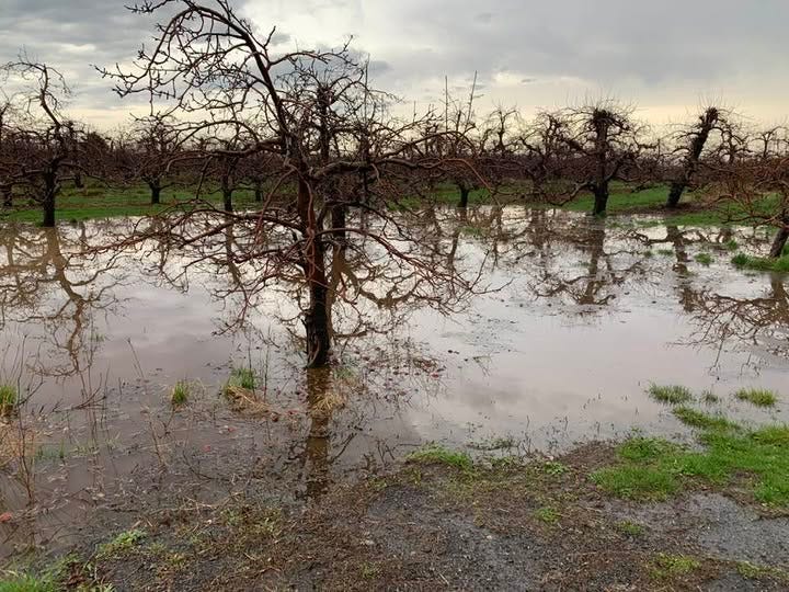
This is a pic. I took of ponding of water that occurred in the orchard across from my house in Alpine Township. It’s happened before - no harm from this and will likely be gone in a day or two.
Driving around Alpine Township, I did see some temporary ponding of water in some fields and creeks were running high.
The Storm Prediction Center lowered the chance of a severe thunderstorm Friday from Level 2 (Slight Risk - in yellow on the map to level one Marginal Risk (in dark green on the map below).
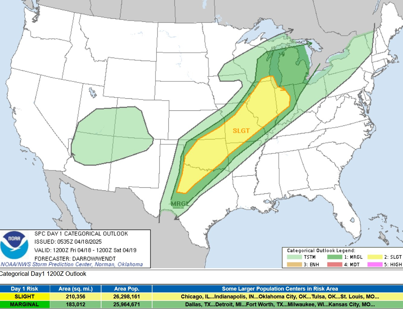
The Storm Prediction Center said: “Latest model guidance does not allow the upper Midwest/Great Lakes region to destabilize appreciably as buoyancy will be somewhat limited across this region. Even so, strong flow/shear warrant some concern for convective organization, and some risk for wind/hail will accompany frontal/pre-storms as the boundary advances east through the period.”

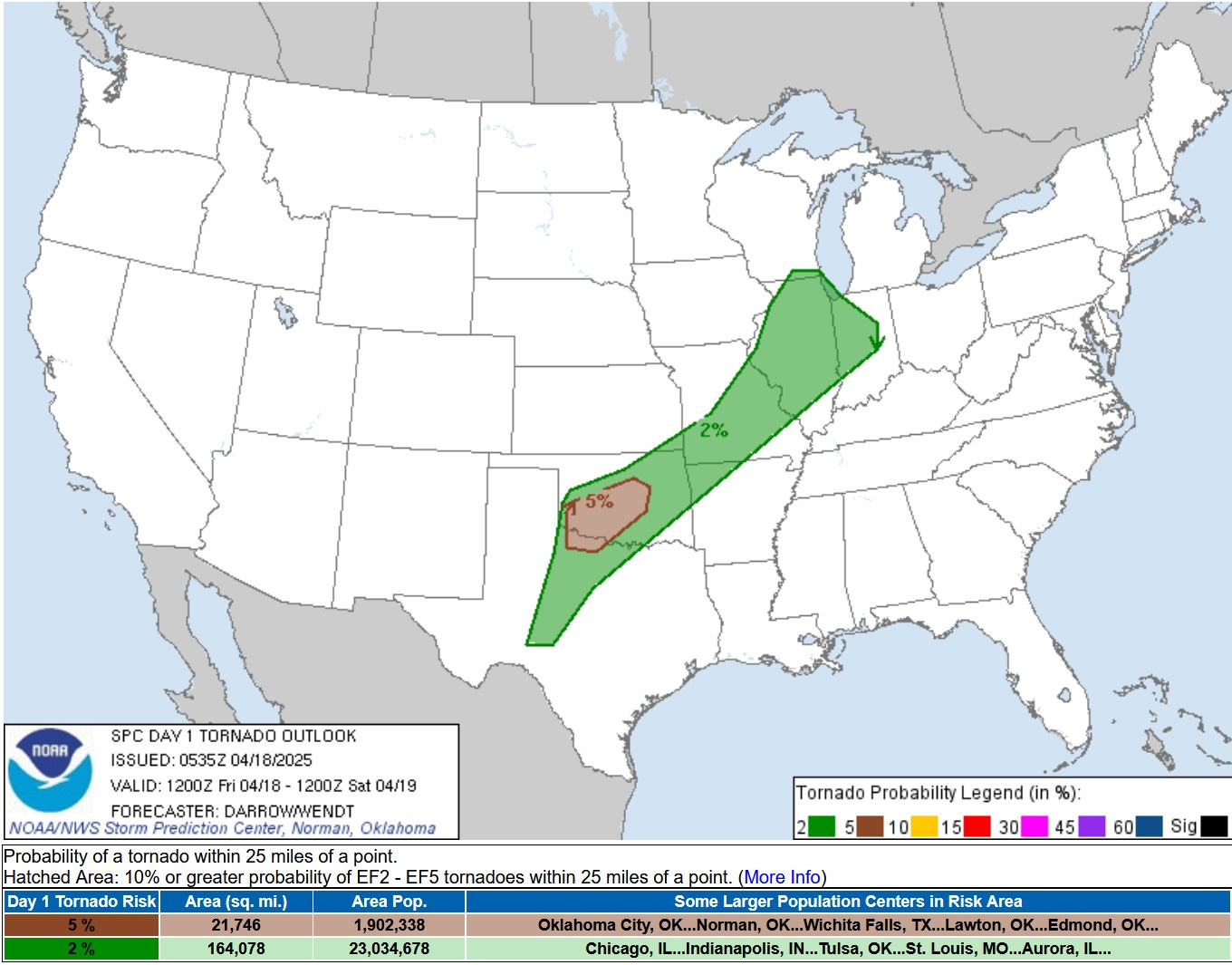
Below was the SPC tornado forecast for this Friday PM/night. They took Lower Michigan out of the 2% chance of a tornado within 25 miles of a given spot. So, the risk is not zero, but is quite small at less than 2%. So far, no tornadoes have been reported in Michigan.
Below is the Severe Wind Forecast from SPC. Lower Michigan was lowered from a 15% chance to a 5% chance. The yellow area on the map represented at least a 15% chance of a severe wind report within 25 miles of a given point.
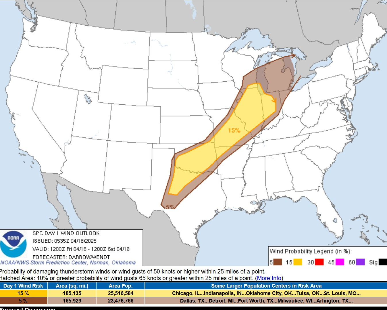
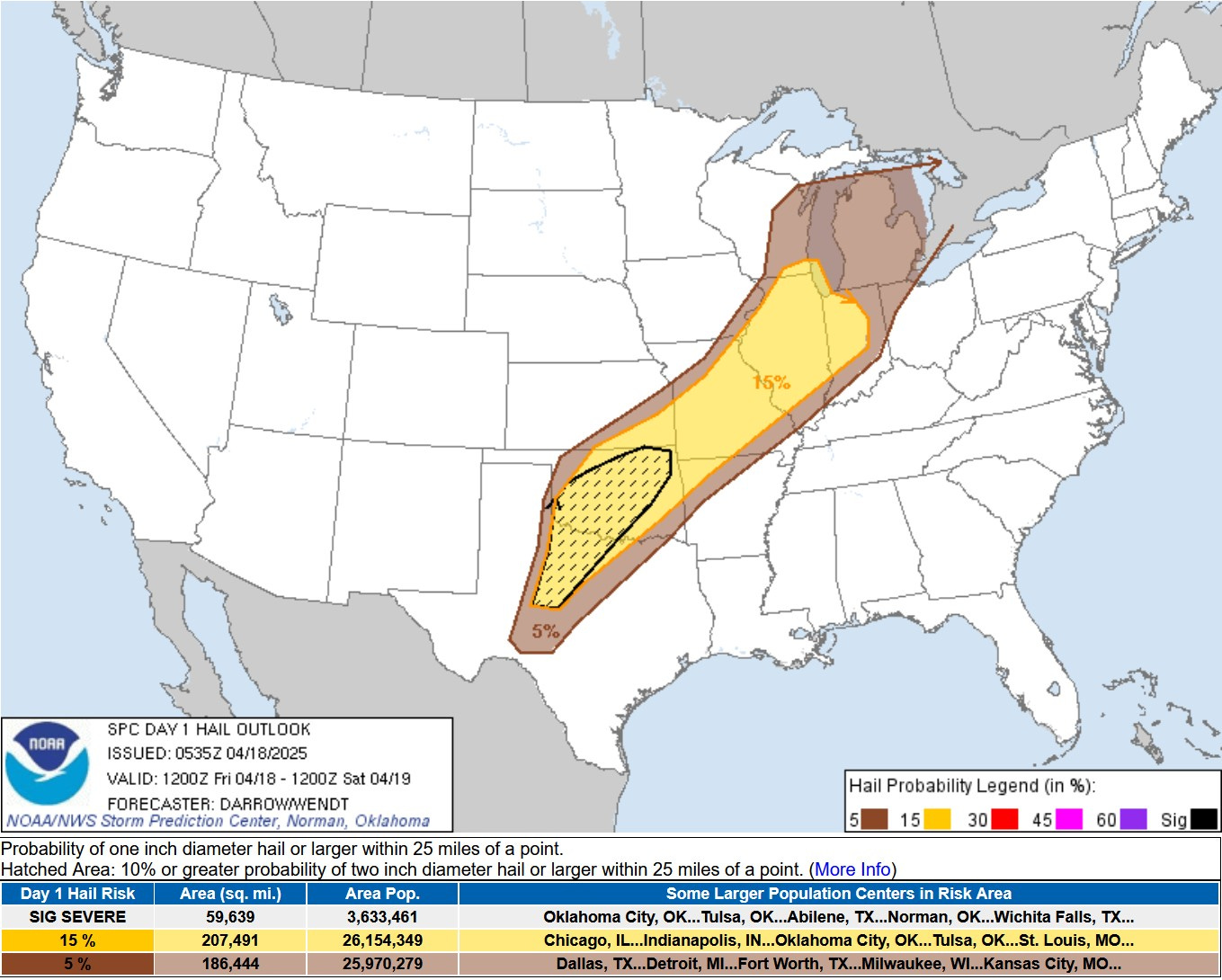
The Severe Hail Forecast is similar to the wind forecast. The hail threat for Michigan was lowered from 15% (chance of a severe hail report within 25 miles of a given point. covers most of Lower Michigan) to just 5%. Severe hail is 1” or greater in diameter. The hatched area in Oklahoma and Texas was a 10% chance of a report of hail 2” in diameter or greater with 25 miles of a given point.
On April 2 ( when we had 12 tornadoes in Lower Michigan) southern Lower Michigan was in the Enhanced (level 3) Outlook Area, so we’re two steps lower that that now.
Also - the kp-index (which gives you an idea of whether you can see the northern lights) peaked at a relatively high 7.67 Wednesday afternoon - so where it was dark (and clear) across eastern Europe the aurora was visible. However the index crashed to 2.67 by the time it was past twilight in West Michigan.
The average high/low temperature is now up to 59/38 in Grand Rapids. The days continue to get longer, with our sunrise today at 6:57 AM and sunset at 8:27 PM. So far, the month of April has been nearly 3 degrees cooler than average in G.R.
Gaylord picked up 2.3” of snow on Tuesday - they are now up to 204.6” for the season, a new season record. Gaylord had the EF3 tornado in May 2022, now a historic ice storm and a record season snowfall.
Power Outage Update: Good progress continues to be made to restore power after the devastating ice storm that occurred back in late March. There are now just 1,755 customers without power (as of 2:55 am Thursday). This includes 585 in Montmorency County (5.6% of the county), 483 in Oscoda Co. (5% of the county), 225 in Presque Isle Co. 145 in Mackinac Co., 122 in Cheboygan Co. and 89 in Alcona Co.
Presque Isle Electric and Gas has replaced 1,529 utility poles. That’s more poles than they usually replace in 3 years.