


Winter Weather Advisory
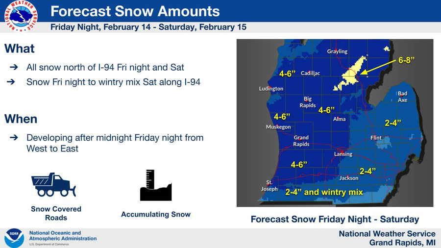
Look for 2-6" of new snow, along with a chance of a period of icing south and southeast of Kent County.

Here we go again…The National Weather Service has posted a Winter Weather Advisory for West Michigan.
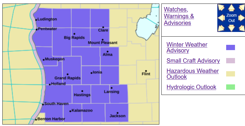
Here’s the details: “* WHAT...Snow expected. Total snow accumulations between 3 and 6 inches. * WHERE...Portions of central, south central, southwest, and west central Michigan. * WHEN...From 11 PM this evening to 7 PM EST Saturday. * IMPACTS...Plan on slippery road conditions.
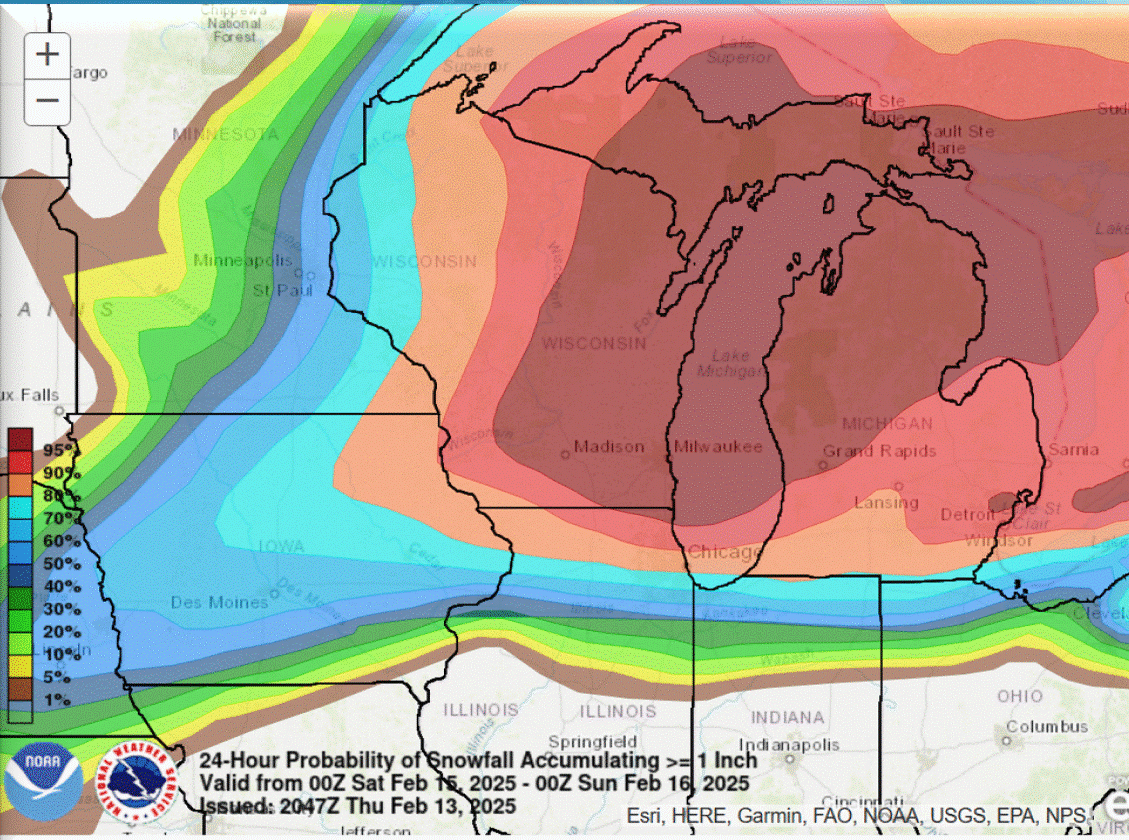
Most all of Michigan will get snow and slippery road conditions later tonight and Saturday. South of a line from Holland to Saginaw, there could be a period of freezing rain. That would slightly lower snow totals.
The snow will be widespread, cover much of Lower Michigan and part of Upper Michigan.
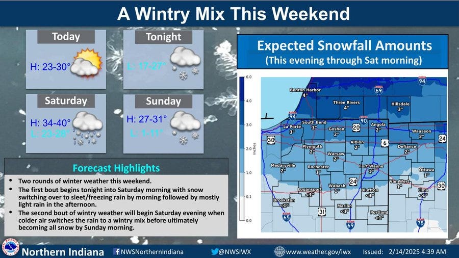
The graphic above is for northern Indiana, northwest Ohio and the Michigan counties that border Indiana. This area will see a mix of precipitation, including the possibility of a period of rain.
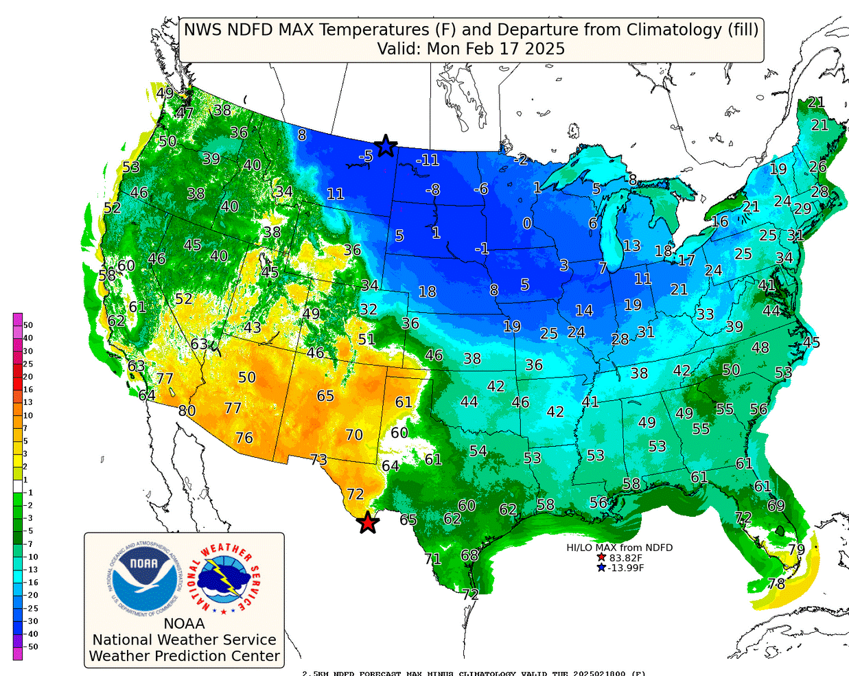
After the snow, arctic air moves into Michigan. Here’s forecast temperatures for Monday afternoon. It’s just 13 in Grand Rapids - that’s about 20 degrees colder than average. The lake warms us a few degrees - it’s just 7 in Chicago…and the cold air will stick around through the middle of next week.
So far, February is running 1 degrees colder than average in Grand Rapids…after January was 2.6 degrees colder than average. In the contiguous U.S., this was the coldest January since 1994.
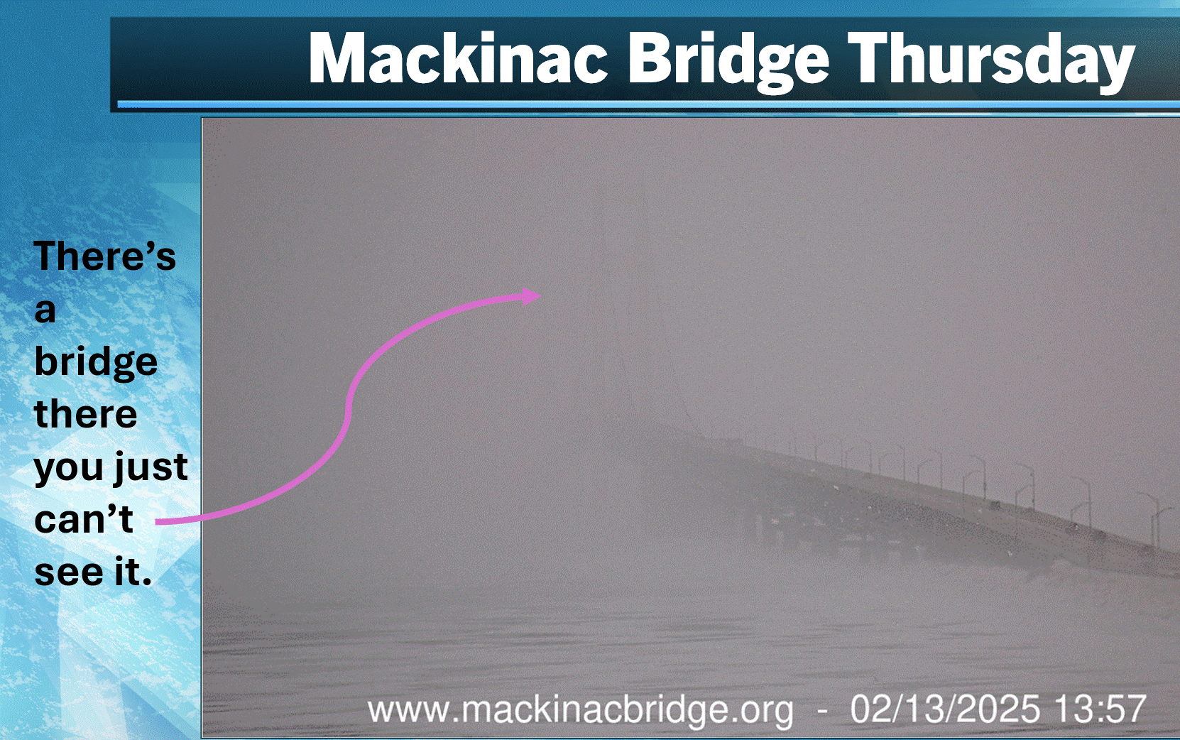
This is a picture from the webcam at the Mackinac Bridge Thursday afternoon It’s snowing hard enough that you can’t see most of the bridge. The Bridge Authority warned that the bridge was icy and slippery. Would you like to drive over the bridge in that kind of weather?
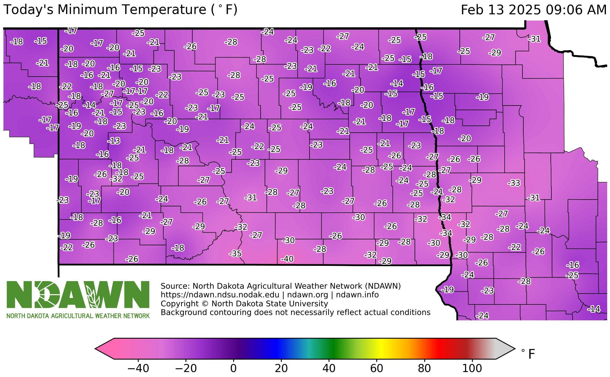
It’s was 40 below zero in Zeeland Thursday morning…Zeeland, North Dakota. This is a map of low temperatures in North Dakota. You can see the -40 in the middle by the bottom of the map. This was the coldest temperatur in North Dakota in over 3 years. Cook, Minnesota was also 40 below zero. Early Thursday, Linton ND had a wind chill factor of 62 below zero!
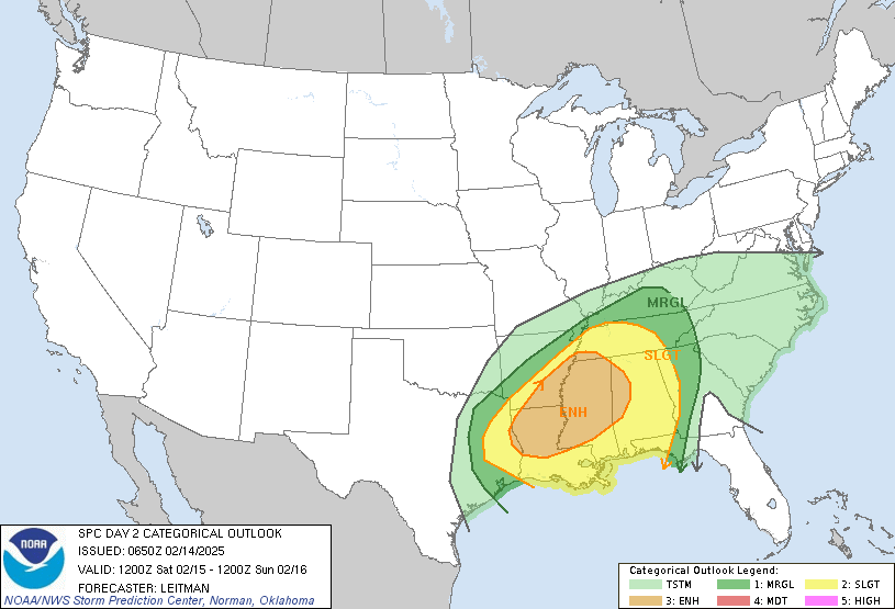
While we get snow on Saturday, severe thunderstorms will hit the South. This is the severe weather outlook map from the Storm Prediction Center for Saturday/Saturday night. You can see an Enhanced Outlook Area (in orange on the map above) from far east Texas across Louisiana, southeast Arkansas, Mississippi and into western Alabama. The Slight Risk Area (in yellow on the map) runs from east Texas to the tip of North Carolina. The Storm Prediction Center warns of “Scattered to numerous damaging wind gusts and a few tornadoes.”
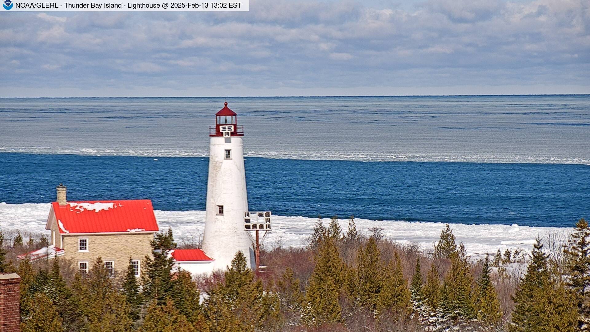
Here’s a pretty pic. of the Thunder Bay Island lighthouse from Thursday PM. There’s ice at the shore, then a stretch of open water, then more ice as you look out over Lake Huron.
Great Lakes ice extent is up to 33.2% and Lake Michigan now at 24.0%. Those numbers will increase as the general cold pattern will continue all of next week.
Amazing the ice is not higher or at least at average for this point in winter considering the cold January and February. The above average water temps in the fall really made a difference along with some of the wind storms to break up the ice. My guess is we hit 50%-55% ice cover for the Great Lakes for the season.